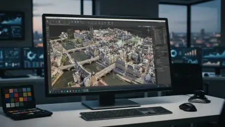

The integration of standalone PLY and OBJ file support simplifies the process of bringing external geometric data into a unified post-processing environment. The release of DJI Modify version 1.7.0 represents a pivotal shift in how drone professionals approach the post-processing of 3D models. Rather than serving as a simple cleanup tool for removing artifacts, this update transforms the software into a proactive refinement suite that bridges the gap between raw data collection and high-fidelity deliverables. By providing users with more granular control over both the geometric structure and the visual aesthetics of their models, developers are addressing the common bottlenecks that often occur when moving from as-captured photogrammetry to presentation-ready digital twins for surveying and construction. The ability to manipulate complex meshes without losing spatial accuracy ensures that digital assets remain technically sound while meeting the aesthetic demands of modern industrial clients in 2026.
Strengthening Structural Geometry and Visual Fidelity
One of the most significant additions in this version is the object-based scene enhancement feature, which allows users to utilize a dedicated model library. In traditional photogrammetry, small or complex structures like rooftop HVAC units or specific architectural details often appear distorted or incomplete due to occlusion or sensor limitations. Version 1.7.0 allows users to select pre-made components and place them directly onto the 3D mesh, effectively patching holes in the data with high-quality assets. These components are fully integrated into the project, ensuring they can be post-processed and exported as part of a single, unified model. This shift from simple subtraction of errors to the active addition of corrected geometry marks a transition for the software. It empowers specialists to deliver models that look as though they were manually modeled by hand, even though the majority of the work was automated through high-resolution aerial capture and rapid placement.
Beyond structural fixes, the update introduces a custom texture tool designed to resolve the smeared or patchy appearances common on vertical facades and reflective surfaces. These visual artifacts frequently occur when the software tries to reconcile multiple camera angles on a surface that reflects light or lacks distinct features. Users can now identify specific areas on a mesh and prompt the software to re-map the original, undistorted source photographs back onto the surface with superior alignment. This ability to restore visual clarity, combined with the option to import external photos for texture mapping, ensures that the final model is a visual truth suitable for high-stakes stakeholder presentations and marketing materials. This level of aesthetic refinement was previously only possible in expensive, general-purpose 3D modeling suites, but it is now accessible within the specialized drone mapping ecosystem, saving hours of manual retouching in external software programs.
Elevating Topographic Inspection and Professional Accuracy
For surveyors and civil engineers, the introduction of 3D Digital Elevation Model (DEM) viewing within point cloud projects is a major functional leap that streamlines the validation phase. Previously, inspecting terrain results often required a 2D perspective, which could hide anomalies like digital pits or mounds caused by vegetation interference or sensor noise. By visualizing these models in a full 3D context, professionals can intuitively identify and correct topographic errors that might skew volumetric calculations or grading plans. This immersive environment allows for a more comprehensive assessment of the ground surface, ensuring that the terrain data handed over to clients is both accurate and reliable. The capability to rotate and inspect the digital terrain as a physical object enables a higher standard of quality control, allowing teams to spot minute inconsistencies in the mesh that would have remained invisible in a traditional flat-map representation.
The update also caters to high-end LiDAR workflows by supporting up to 15 returns in LAS 1.4 point clouds. This is particularly valuable when mapping heavily forested areas or sites with dense undergrowth, as multiple returns allow the sensor to see through dense canopy to the ground below. Increasing the return count ensures that even the most cluttered environments yield a clear ground-level profile, which is essential for accurate contour mapping and site preparation. Furthermore, a new orthographic viewing mode has been implemented to remove the dimensional distortion typically found in perspective views. This allows users to compare the relative sizes of buildings and site components with surgical precision across the entire project area. By eliminating the narrowing effect of perspective, surveyors can verify that all objects are scaled correctly in relation to one another, a feature that is indispensable for verifying that a digital twin adheres to the strict measurements of a real-world site.
Navigating Software Integration and Processing Benchmarks
To reduce friction in daily operations, version 1.7.0 has simplified the way users bring external data into the software environment by supporting standalone PLY and OBJ mesh imports. This move makes the software more flexible for users who need to combine various data sources without navigating complex file conversions or proprietary limitations. However, the software remains firmly rooted in the DJI ecosystem, as it is primarily optimized for models reconstructed in DJI Terra version 4.0.0 or later. This reinforces a walled garden approach that incentivizes staying within a single brand’s toolset to ensure maximum compatibility and stability. While this limits the ability to use third-party photogrammetry engines, the seamless handoff between DJI Terra and DJI Modify creates a streamlined pipeline that minimizes the risk of data corruption or coordinate system shifts. For firms already invested in the hardware, this integration provides a significant speed advantage in the final stages.
Despite the expanded feature set, the software maintained demanding technical requirements that users had to plan for during implementation. It required a Windows-based operating system equipped with a dedicated NVIDIA graphics card to handle the heavy processing loads, along with a persistent network connection for license validation. Ultimately, DJI Modify 1.7.0 underscored a broader industry trend where the value of a drone mission was increasingly defined by the quality and utility of the final post-processed deliverable rather than the flight itself. Moving forward, mapping firms should audit their current workstation capabilities to ensure they can leverage these advanced modeling tools without performance bottlenecks. By adopting these integrated cleanup and refinement protocols, professionals successfully moved away from raw data toward a standard of high-fidelity modeling that met the rigorous requirements of 2026 industrial projects. The focus shifted from merely collecting data to mastering the final digital representation.